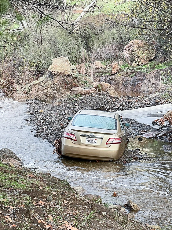
LOS ANGELES – Following light to moderate rain falling across most of the Southland Wednesday, the brunt of the “bomb cyclone” moved across the state, with the full force of the storm hitting Riverside County Thursday morning.
The National Weather Service had predicted “A strong Pacific storm system will affect the area…with strong winds, damaging surf, heavy rain with flooding and high elevation snow.”
California Gov. Gavin Newsom declared a state of emergency to allow for a quick response and to aid in cleanup from another powerful storm that hit just days earlier.
“We anticipate that this may be one of the most challenging and impactful series of storms to touch down in California in the last five years,” said Nancy Ward, the new director of the California Governor’s Office of Emergency Services.
“Though the rain and winds are the main story for Thursday, high elevation mountain snow will occur as well,” according to the NWS. “With the low pressure system tapping into warm atmospheric river moisture, snow levels are expected to be quite high … above 7,000 feet during the heaviest precipitation. After the cold front passes Thursday afternoon, snow levels will drop to around 6,000 feet.”
Above 7,000 feet, snowfall accumulations could exceed 12 inches, while
an inch or less may accumulate at the lower mountain levels, forecasters said.
The storms won’t be enough to officially end the state’s ongoing drought, now entering its fourth year. The U.S. Drought Monitor showed that most of California is in severe to extreme drought. Since the state’s major reservoirs are low, they have plenty of room to fill with more water from the storm, officials said.
Still, trees are already stressed from years of limited rain. Now that the grounds are suddenly saturated and winds are heavy, trees are more likely to fall. That could cause widespread power outages or create flood hazards, said Karla Nemeth, director of the state’s Department of Water Resources.
“We are in the middle of a flood emergency and also in the middle of a drought emergency,” she said during an emergency briefing.
A series of “weak disturbances” are anticipated over the weekend, but “there will likely be drier and less cloudy intervals in between the clouds and rain,” forecasters said.
Temperatures, meanwhile, will remain about six degrees cooler than normal through the weekend.
According to meteorologists, the storm train, which began last month with a dip in the jet stream, shows no signs of letting up, with additional inclement weather anticipated Sunday night through Tuesday.


Very wonderful info can be found on weblog.Leadership