
Storm
CORONA – Warm spring temperatures will give way to winter-like weather as a cold storm moves into the region T, bringing low-elevation snow, showers, and the possibility of severe thunderstorms.
“Widespread precipitation is expected from the coast to the mountains into Friday evening with the snow level lowering to 3,000 to 3,500 feet,” according to the National Weather Service.
There is also a slight chance of thunderstorms for Friday afternoon, forecasters said.
Onshore flow strengthened on Thursday with … “high temperatures much cooler, as much as 15 degrees cooler for the valleys,” according to the NWS.
Gusty winds are expected to continue through Friday night, forecasters said. The strongest gusts are expected near the desert slopes of the mountains and near the coast.
Much of the rain is expected through Friday afternoon, according to the NWS.
In addition to the slight chance for thunderstorms Friday, there could be small hail from some of those thunderstorms, forecasters said.
Rainfall is expected to range from around one-quarter inch near the coast to around an inch in the mountains. The deserts are expected to get less than one-quarter inch of rain.
Snowfall in the mountains through Friday evening of 1 to 3 inches is possible in areas as low as 3,000 feet; 3 to 6 inches from 4,500 to 5,500 feet, and 6 to 12 inches from 5,500 to 6,500 feet, according to forecasters.
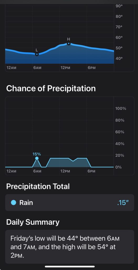
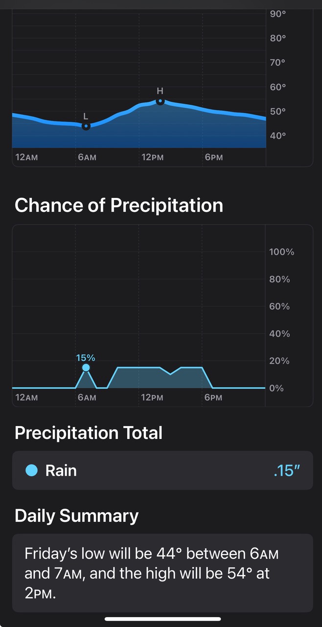
High temperatures on Friday will be cool, mostly in the 50s for coastal areas, the 40s to mid-50s for the valleys, 40s for the high desert, mid-50s to mid-60s for the lower deserts, and in the mid-20s to mid-30s for the mountains.
The weekend is expected to be drier and a little warmer, but a low-pressure system could bring some showers sometime around Sunday night, according to the NWS.
For More Weather Visit www.zapinin.com/weather.